Visualizing Swiss Lakes with GeoJSON
- Oliver Heisel
- Nov 19, 2025
- 1 min read
Working with geographic data becomes much more intuitive when it is presented visually. To support clearer lake based weather monitoring and mapping, a complete GeoJSON collection of Swiss lakes has now been created and published. The data set is openly available on GitHub and offers precise lake shapes that can be integrated into web maps, dashboards or analytical tools.
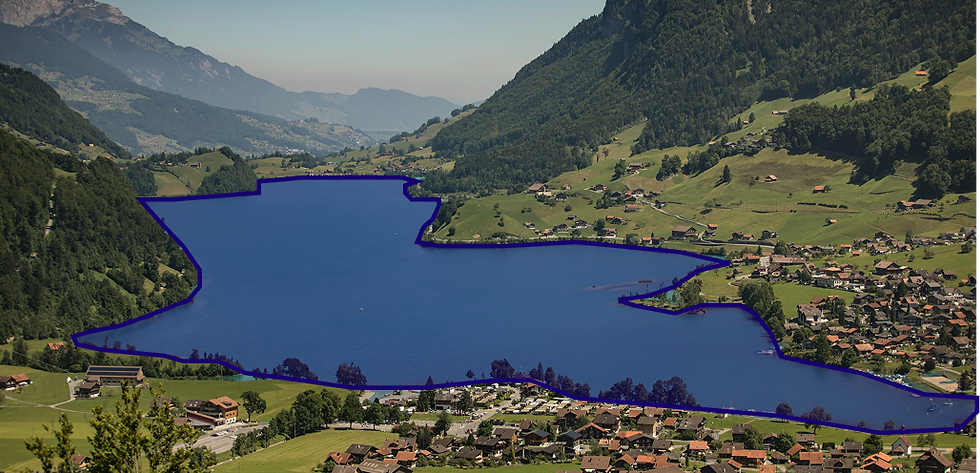
The project focuses on clean geometry, consistent naming and practical usability. Each lake is stored as an individual GeoJSON file, making it easy to use the data in applications that only require specific regions. Developers can plug the files directly into map frameworks like Leaflet or Mapbox and immediately render accurate outlines of the Swiss lake landscape.
This work grew out of the need to visualize lake specific storm warnings on sturmwarnung.online. Accurate shapes allow the platform to highlight affected areas and create a clearer connection between warning data and the actual geography. What began as a helper for one project can now be used by anyone who needs detailed Swiss lake geometry for visual or analytical purposes.
The dataset will continue to improve as more lakes and refinements are added. Contributions and feedback are welcome. Github-Repository:

Comments